Main window
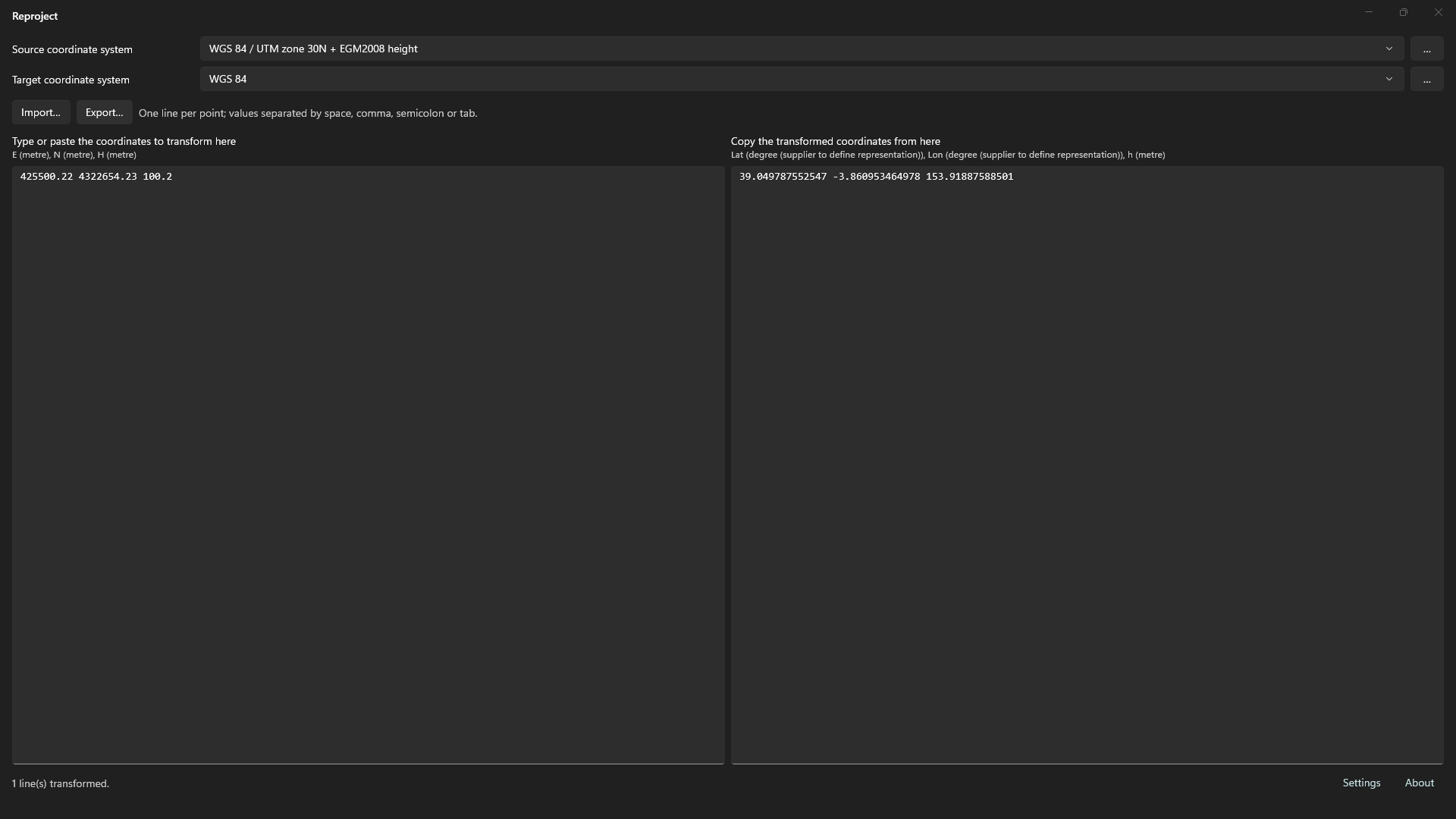
From top to bottom, the main window contains:
- Source coordinate system: drop-down and ….
- Target coordinate system: drop-down and ….
- Import… and Export….
- Two text columns: input coordinates on the left and transformed coordinates on the right.
- Status bar with Settings and About links.
- Error banner, present only if a transformation cannot be created.
Transform coordinates step by step
- Click … beside Source coordinate system and select the input system. See Coordinate system selection.
- Click … beside Target coordinate system and choose the output system.
- If EPSG offers several transformations, Select transformation appears. Choose one. See Transformations and geoid models.
- Enter or paste coordinates into Type or paste the coordinates to transform here, or click Import… to read a file.
- Copy from Copy the transformed coordinates from here, or click Export… to save results.
Transformation runs when systems are selected and whenever the left column changes. There is no transform button.
Source and target drop-downs
Both share the 12 most recently selected systems, newest first. Selecting an entry is equivalent to choosing it with ….
Restarting restores source, target, recent systems and the chosen transformation for that pair.
Input coordinate format
- One line per point.
- Separate values with space, comma, semicolon or tab.
- Decimal separator: period (
.). A comma separates values and cannot be a decimal separator. - Each line needs as many values as the source system has axes. Extra values are discarded.
- Value order follows source axes. Axes appear below each column title, comma-separated, with units in parentheses.
- Empty lines are preserved in output.
Example for a projected system with height:
435600.42 4532954.10 602.59
435601.23 4532961.10 600.42
Change geographic or projected axis orientation in system selection under Axis order.
Output format
- One output line per input line, at the same position.
- Space-separated values with decimal periods and up to 12 decimal places.
- Value order follows target axes, shown below the right column title.
A failed line does not stop other lines. It shows an error instead:
| Message | Cause |
|---|---|
· error: expected N values |
Fewer values than source axes. |
· error: invalid numeric value |
A value is not numeric. |
· error: <message> |
Point transformation failed. The calculation engine supplies the message. |
Import and export coordinates
- Import… opens
.txt,.csvor any other extension and copies its contents to the left column. It must follow the input format above. - Export… saves right-column contents as
.txtor.csv. Proposed filename:transformed-coordinates.
Status bar
Shows:
- At startup, the EPSG database path or its opening error.
- When creating a transformation, source and target names (
origen → destino). For equivalent systems: “Identity transformation (source and target are equivalent).” - When transforming, the transformed line count and error count, if any.
Links open:
- Settings: geoid model directory. See Transformations and geoid models.
- About: EPSG catalog version, Reproject and CrsKit repositories, and EPSG data terms.
Error banner
If a transformation cannot be created, the full message appears in the lower banner: “Could not create the transformation: …”. The output column remains empty. Close the banner with its close button or by creating a valid transformation.