Compare clouds
This tool compares two LiDAR point clouds by elevation and classification.
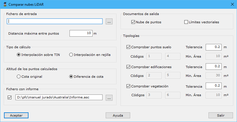
Dialog fields:
- File for projection: LiDAR cloud file to compare with the current document.
- Maximum distance among points: maximum neighbor distance, based on point density.
- Type of computation:
- TIN interpolation: calculates on a TIN generated from all points of the specified type.
- Grid interpolation: calculates on a grid whose step equals maximum point distance.
- Point height: difference points retain original elevation or store the difference between clouds.
- Report file: ASCII file storing comparison results.
- Output documents:
- Point cloud: compared points whose differences exceed specified tolerances.
- Vector boundaries: boundaries formed from error points and exceeding the specified area.
- Typologies: Ground, Buildings or Vegetation. For each:
- Tolerance: positive or negative elevation difference in meters above which an error is detected.
- Codes: code for recording this type's vector boundaries, if selected as output.
- Min. Area: minimum boundary area for recording, if vector boundary output is selected.