Coordinate reference system parameters
These dialogs show horizontal or vertical coordinate reference system parameters for the drawing window or a drawing file. They are read-only: they do not change the reference system.
Opening the dialogs
- On the Coordinates toolbar, open the units button's arrow menu and select Show horizontal reference coordinate system... or Show vertical reference coordinate system....
- In the Drawing files pane, select the same options in a file's context menu.
Horizontal system
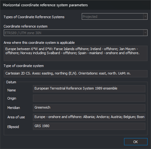
- Types of Coordinate Reference Systems: system type: Local, Projected or Geographic 2D.
- Coordinate reference system: system name.
- Area where this coordinate systems is applicable: geographic area where EPSG defines the system.
- Type of coordinate system: system axes, their orientation and unit of measure.
- Datum: system geodetic datum. For a projected system, the datum of its base geographic system.
- Name: datum name.
- Origin: description of the datum origin. Empty when EPSG does not define one, as for the ETRS89 datum, which is an ensemble of realizations.
- Meridian: longitude origin meridian.
- Area of use: area where EPSG defines the datum.
- Ellipsoid: datum ellipsoid.
Vertical system
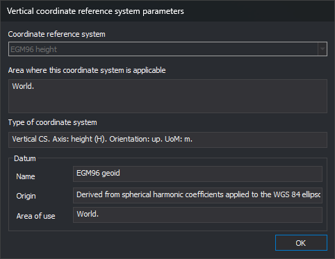
- Coordinate reference system: vertical system name.
- Area where this coordinate system is applicable and Type of coordinate system: as for the horizontal system.
- Datum: vertical datum, with its Name, Origin and Area of use.
Non-EPSG systems
If the reference system has no EPSG code because it was read from WKT without a code, the dialogs show information contained in the WKT itself: for the horizontal system, datum, meridian and ellipsoid names; for the vertical system, the datum name. Area, coordinate system type, origin and area of use remain empty because that information is only in the EPSG catalog.
Unknown system
If the reference system is unknown, these dialogs are replaced with this message: