Select color range
Displaying the surface as colored triangles or vertices opens a dialog for choosing a color range. This dialog also appears when displaying a LiDAR point cloud by elevation.
The color range depends on element elevation. Complete these fields:
- Min height and Max height: digital model elevation limits, shown to help build the height interval table.
- List of colour sequences: color range name. Add, delete or duplicate tables under another name for use in different files.
- Height interval table: colors assigned to different heights. Add, delete or edit intervals to fit the document's elevation range. Surfaces above or below the table's limits are not colored.
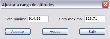
- Fit to range...: fits an interval table to specified elevation limits through this dialog.
- Hypso curve...: displays surface area distribution by elevation to help design the color range.
For more about color ranges, see Hypsometric tints.