Compare two DEMs
This tool compares two digital models of the same area and can produce a results report with the differences found.
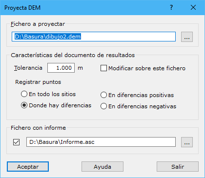
The dialog contains the following fields:
- File for projection: path to the digital model file to project onto the current model. The button to the right opens Windows Explorer.
- Output document: configures the calculation with the following parameters:
- Tolerance: linear value in meters above which an elevation difference is considered unacceptable, representing an error between the models.
- Output over this document: modifies the current file to store the differences found. This saves memory because no new differences document is generated.
- Record points: chooses where to record points:
- Everywhere: records all projected points, with their elevation set to the difference found.
- Just in differences: records only points whose differences exceed the tolerance.
- Just in positive differences: records only points whose positive differences exceed the tolerance.
- Just in negative differences: records only points whose negative differences exceed the tolerance.
- Report file: generates a text file with projected points, differences and a statistical summary. Use the button to the right to select its location.