Normalized digital surface model
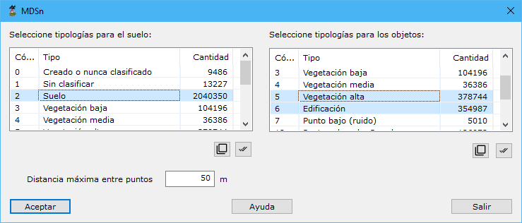
Calculates a point cloud whose elevations are height differences above a base.
Required parameters:
- Select typologies for ground: types used to calculate a base DTM for height differences.
- Select typologies for objects: types whose heights above the base are calculated.
- Max distance among points: maximum neighbor distance, based on point density.