Delete peaks
Finds and classifies points higher than their surroundings. Including them in a DTM would produce spikes due to their elevation differences.
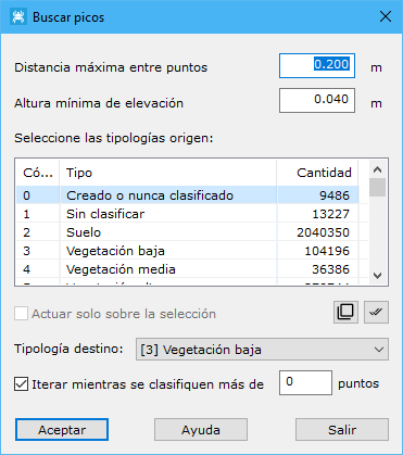
Required parameters:
- Maximum distance: maximum distance for neighboring terrain points, based on point density. Defines the area covered by each measurement point.
- Minimum elevation height: minimum elevation difference between a point and its surroundings.
- Source types: point types used in calculation.
- Target types: type assigned to detected points.
- Only in the selection: processes only currently selected points.
- Iterate while more than x points are classified: repeats while the classified count exceeds this value.