Export GTOPO30
The program exports the generated digital model to USGS GTOPO30 format. Windows file selection specifies the file name and folder, with two additional fields for grid spacing and point elevation units:
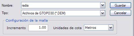
Two files are generated: the point grid and a header containing information about the generated digital model.