Preprocess
Processes a LiDAR file without opening or displaying it. Change coordinates or split the file into parts, useful for large files.
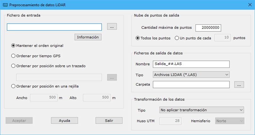
Required parameters:
Source file: input file name. Use the button to the right to select it in Windows Explorer. After specifying it, Information opens Laser Doc properties with its contents. Reading options:
- Keep the original order: processes points in file order.
- Sort by GPS Time: reads once to sort by GPS time before processing.
- Sort by position over a track: projects points onto an axis line and sorts by projected position. The axis can be stored as BIN, DXF, DGN or Shape.
- Sort by position in a grid: sorts by a grid whose cell dimensions are set with Size X and Size Y.
Output point cloud: defines the resulting cloud.
Specify the Maximum number of points in each output file and use all points or one point in every specified count.
Output files:
- Name: output file name. Hash signs represent indices when splitting files. For example, "Salida_##.LAS" generates "Salida_01.LAS", "Salida_02.LAS", and so on.
- Type: output file format.
- Folder: output storage folder.
Data transformation: optional coordinate change, from Cartesian coordinates to UTM or Geographic coordinates to UTM.