Grid from LiDAR
Generates a regular point grid interpolated from LiDAR points. Also finds and classifies points differing greatly from their surroundings, excluding them from interpolation.
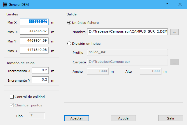
Required parameters:
- Limits: maximum and minimum X and Y coordinates.
- Cell size: grid cell size.
- Quality control: checks for points with abnormal elevations compared with others in the same cell.
- Classify points: assigns points failing quality control the classification specified in Type.
- Output:
- Single file: one file in MDTopX grid DEM format.
- Split into sheets: multiple files at the specified sheet size, named using Prefix. Hash signs are replaced by sheet numbers: "salida_##" generates "salida_01", "salida_02", and so on.