Compare 3D clouds
This tool compares two point clouds.
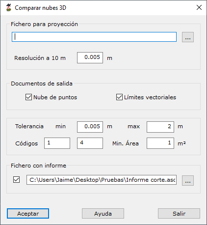
Required parameters:
- File for projection:
- Name: reference model file to compare with the new scan.
- Resolution at 10 m: distance step for comparisons.
- Output documents:
- Point cloud: generates a cloud of points where differences were found.
- Vector boundaries: generates boundaries grouping points where differences were found.
- Output document parameters:
- Tolerance: minimum and maximum differences to consider.
- Codes: codes for negative and positive difference areas, respectively.
- Min. Area: minimum area for a region to be considered.
- Report file: optional ASCII report.