Edit image orientation
This tool edits an image's georeferencing parameters. Parameters differ for orthogonal and perspective orientation.
For an orthogonally oriented image, the dialog displays:
- Pixel size: pixel size in ground coordinates.
- Left top corner X: upper-left image corner X coordinate in ground coordinates.
- Left top corner Y: upper-left image corner Y coordinate in ground coordinates.
For a perspective image, the dialog displays:
- Interior orientation:
- Focal length: principal distance in millimeters.
- Pixel size: pixel size in microns.
- Principal Point X: principal point X position in millimeters.
- Principal Point Y: principal point Y position in millimeters.
- Exterior orientation:
- Omega: angle about the X axis, in degrees.
- Phi: angle about the Y axis, in degrees.
- Kappa: angle about the Z axis, in degrees.
- Projection centre X: projection center X coordinate in ground coordinates.
- Projection centre Y: projection center Y coordinate in ground coordinates.
- Projection centre Z: projection center Z coordinate in ground coordinates.
- Ground height: mean terrain elevation in ground coordinates.
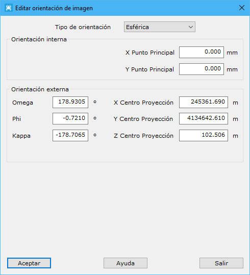
For a 360-degree image, the dialog displays:
- Interior orientation:
- Principal Point X: principal point X position in millimeters.
- Principal Point Y: principal point Y position in millimeters.
- Exterior orientation:
- Omega: angle about the X axis, in degrees.
- Phi: angle about the Y axis, in degrees.
- Kappa: angle about the Z axis, in degrees.
- Projection centre X: projection center X coordinate in ground coordinates.
- Projection centre Y: projection center Y coordinate in ground coordinates.
- Projection centre Z: projection center Z coordinate in ground coordinates.
After georeferencing and saving the image to disk, an ASCII file with georeferencing parameters is generated. Its type depends on the image:
- Perspective or spherical images: ORI extension.
- Orthogonal images: ORT extension. Depending on the output image format:
- TIF also stores orientation parameters in the image file header and generates a TFW file for loading in third-party applications.
- JPEG generates a JPW file for loading in third-party applications.
Example ORI file for spherical image orientation:
[Orientacion]
Modo=Externa
[Externa]
m0=-0.9789410669 -0.2038119630 0.0116220129
m1=-0.2038836663 0.9789805160 -0.0053478801
m2=-0.0102877623 -0.0076047981 -0.9999181611
CentroProyeccion=596407.3353 3125647.8420 82.5872
ZMedia=0.0000
Alcance=0.0000
GPSTime=1299842066.4444465637
ID=2793
TipoOrienta=3
TipoAngulosEsferica=0
CorregirGeodesia=1
MinAltura=0.0000
MaxAltura=180.0000
Example ORT file for orthogonal image orientation:
[ort]
Pixel=0.366396
X=446217.550000
Y=4471383.140000
Z=0.000000
EscalaZ=1.000000
Example TFW file for the same orthogonal image orientation:
0.366396
0.000
0.000
-0.366396
446217.550000
4471383.140000
See also: