Calculate road lines
After road line classification, points are classified as road markings. This tool checks results and corrects errors, displaying detected marking boundaries and potential ones based on intensity.
Draw a line on screen with the left mouse button to change surface types. Selecting incorrectly detected boundaries changes their points to asphalt; selecting undetected boundaries changes their points to road markings.
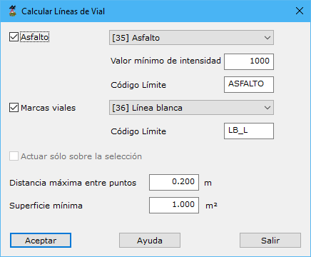
Parameters:
- Asphalt:
- Type
- Minimum intensity
- Boundary code
- Road markings
- Type
- Boundary code
- Work only on the current selection
- Maximum distance among points
- Minimum surface area
See also: