Enter a terrain point of the point file
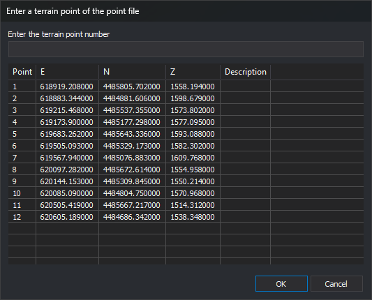
This dialog requests the control point to measure. It is opened by the absolute orientation, aerial triangulation measurement and Orientation panes used by sensors that support it. It shows points from the control point file.
Fields
- Enter the terrain point number: name of the point to measure. Clicking a point in the list copies its name here.
- Point list: file points, with their name (Point), three coordinates and Description. Coordinate column titles are the axis names of the control points' coordinate reference system. If unavailable, the columns are titled X, Y and Z.
- OK: measures the specified point. Entering
0or leaving the field empty selects no point. - Cancel: closes without selecting a point.
Points that are not accepted
- Point absent from the point file:
- In absolute orientation, Digi3D.AI displays “ERROR: The point name does not exist in the points file.” and reopens the dialog.
- In generic orientation, Digi3D.AI displays “Unable to locate the point: name in the loaded control point file.” and reopens the dialog.
- In aerial triangulation measurement, the point is accepted as an aerial triangulation point.
- Name matching a projection center (one of the photo names): Digi3D.AI displays an error and reopens the dialog.