Find road lines
Calculates boundaries from points classified as asphalt and/or road markings, potentially classified earlier with Asphalt.
Results:
- Classifies original document asphalt points as type 35 and road marking points accordingly.
- Generates a vector document with asphalt platform and road marking boundaries.
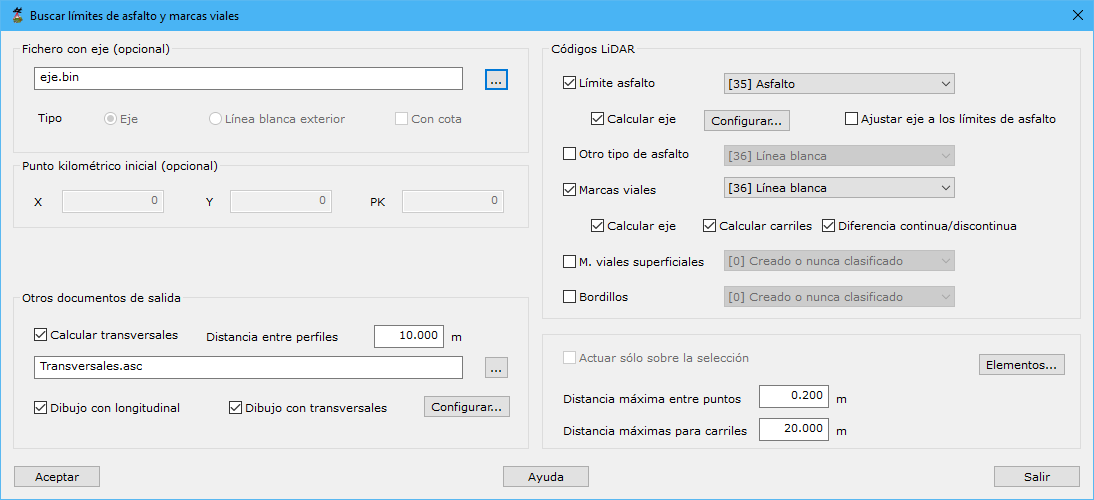
Required data:
- Track file (optional):
- Milestone start:
- Other output documents:
- LiDAR codes
- Work only on the current selection
- Elements
- Max distance among points
- Max distance to join lanes