Slope vectors
This tool calculates vectors defining a digital terrain model's slope. They are recorded in a drawing file as arrows indicating slope direction and magnitude, with text showing the slope percentage.
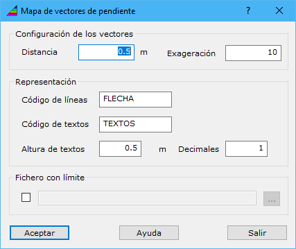
The dialog contains these fields:
- Vector set up: configures lines representing slope direction and magnitude:
- Distance: spacing of slope calculation points.
- Exaggeration: multiplier applied to slope magnitude, determining output vector length.
- Representation: configures entities included in the output document:
- Line code: vector code.
- Text code: code for slope value texts.
- Text height: text size in ground coordinates.
- Decimals: number of decimal places in the slope value.
- Limit file: file containing closed vector entities defining where to calculate slope vectors.
Requires an active grid digital model document.