Sort LiDAR points
Sorts LiDAR points by a property, usually recorded GPS time, or X or Y when GPS time is absent. Each point set usually represents an airborne sensor flight line, or terrestrial scanner stations or different sensors on an MMS system.
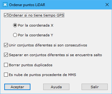
Required parameters:
- Sort without GPS time: sorts points even without GPS time, using a plan coordinate instead.
- Join different sets if consecutive: joins disjoint point sets detected as potentially continuous from their GPS time difference.
- Separate into different sets at gaps: splits sets at significant GPS time gaps caused by joined distinct point sets.
- Delete duplicate points: removes points sharing XYZ coordinates.
- Point cloud from MMS: enable for a terrestrial MMS cloud.