Import GTOPO30
The application imports USGS GTOPO30 files: grids of points spaced 30 arcseconds apart covering different parts of the world. These are DEM digital models that must be converted to MDTop format.
A dialog specifies the area to import and the import precision.
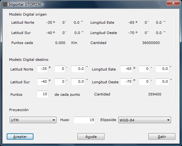
The dialog contains:
- Digital Model source:
- Digital model boundaries in geographic coordinates.
- Grid point spacing in kilometers.
- Estimated point count. If the area includes ocean, there will be fewer points.
- Digital Model target:
- Digital model boundaries in geographic coordinates: specify target model boundaries within the source model's boundaries.
- Points … of each point: the sampling interval, specifying how often a point is selected. For example, 5 imports only one out of every 5 points read.
- Amount: estimated target point count, based on the target boundaries and sampling interval.
- Projection: projection used to transform the geographic coordinates read. Available types are Geographic, direct Mercator and UTM. For UTM, specify the zone in Gore.