Assign superelevation to a road
This tool calculates superelevations needed for a viable alignment according to its curved elements. Specify a previously defined table relating radii to superelevations.
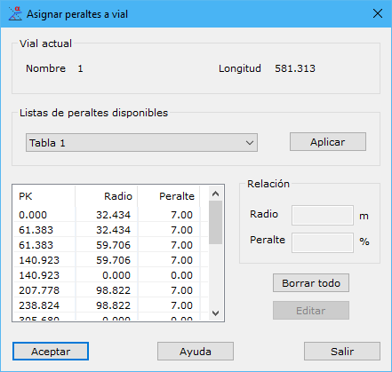
The dialog contains these fields:
- Current road: selected alignment name and length.
- Available Superelevation lists: stored superelevation lists, managed through Superelevation table list. Select a list and click Apply to calculate superelevations for the selected alignment; results appear below.
- Relationships: radius-to-superelevation relationships calculated for the current road, with chainages of important points where they apply, the curved elements' tangent points. Two buttons on the right modify this list: Delete all removes every relationship and resets superelevations to zero; Edit changes one relationship.
Click OK to accept the calculated superelevations. The program automatically calculates transitions between them.
Edit calculated superelevations later by running the tool again and selecting the same road.