Projection onto the point cloud
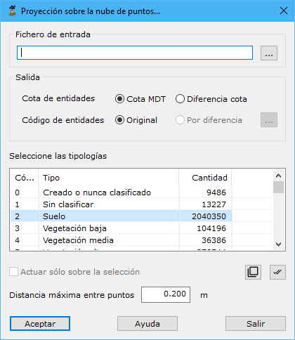
Projects a vector file onto the point cloud, assigning elevations from the projection.
Required parameters:
- Input: file containing entities to project. The button to the right opens Windows Explorer. Formats: DIGI BIN, AutoCad DXF, MicroStation DGN, ESRI Shape or ASCII. Files can contain multiple entities except ASCII, which reads only one as a line.
- Output:
- Entities height: Z stored in each entity vertex:
- DTM height: elevation directly from the point cloud.
- Difference height: difference between the stored file value and its cloud projection, useful for locating entity elevation errors.
- Entities code: recording code or layer:
- Original: retains the original entity code.
- Difference: code based on elevation difference, the preceding parameter's second option. Specify the code-to-elevation-difference relationship with the button to the right.
- Entities height: Z stored in each entity vertex:
- Select source typology: LiDAR point types used for projection.
- Only in the selection: processes only currently selected points.
- Max distance among points: maximum neighbor distance, based on point density.