Classify road lines
Classifies asphalt and road marking points. Run Alignment first.
Results:
- Classifies asphalt, road marking and curb points in the original document.
- Generates a new vector document containing asphalt platform boundaries and road marking boundaries.
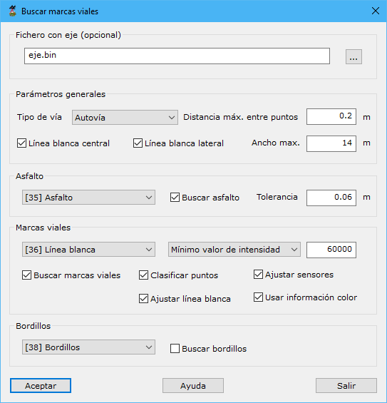
Required data:
- Axis file: optional but recommended, reducing calculations and improving accuracy. If absent, the program estimates the vehicle trajectory from the cloud. Formats: BIN, DXF, DGN, Shape or an ASCII orientation file for MMS images.
- General parameters:
- Road type: Unknown, Urban, Motorway, Road with shoulder or Road without shoulder. Processing adapts to the type.
- Maximum distance among points: maximum spatial neighbor distance.
- Central white line
- Lateral white line
- Maximum width
- Asphalt:
- Type
- Find asphalt
- Tolerance
- Road markings:
- Type:
- Intensity:
- Minimum intensity: minimum point intensity to identify a marking on asphalt.
- Find road markings
- Classify points
- Adjust sensors
- Adjust white line
- Use color information:
- Curbs:
- Type
- Find curbs
Detect road asphalt from MMS data (watch video on YouTube)
See also: