Connecting to a WMS server
Digi3D.AI displays WMS (Web Map Service) layers, such as PNOA orthophotos, beneath drawing cartography. Saves connections in .wmsconnection, loaded as a reference file. Each zoom change requests active layer images for the visible area.
This video shows the full procedure:
Requirements
Server GetCapabilities URL, for example IGN's PNOA:
http://www.ign.es/wms-inspire/pnoa-ma?request=GetCapabilities&service=WMSA drawing window with an EPSG horizontal CRS supported by at least one server layer. See CRS location in drawing files.
1. Creating the connection file
Open the target drawing window. If open, receives the connection automatically in step 5.
Select File/Create a WMS server connection... to open Route to WMS server:
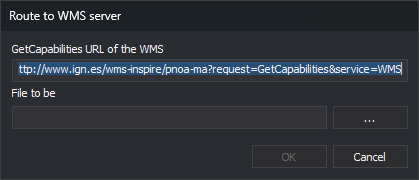
Enter the URL in GetCapabilities URL of the WMS server. Defaults to IGN's PNOA.
Click ... to select the folder and
.wmsconnectionname, or enter File to be created. OK remains disabled without a path.Click OK to connect and read capabilities:
- Connection failure creates no file.
- File creation failure, such as no write permission, displays Unable to create the file with its path.
- Success creates the file. An open drawing window loads it as a reference and shows Drawing file.
2. Loading the connection in the drawing window
Required only if no drawing was open during creation, or to reuse the connection in another drawing window.
- Run LOAD_F or select File/Load reference file....
- Select
.wmsconnection.
No layer available in the drawing CRS produces Incompatible reference coordinate systems, showing the drawing CRS and server-supported CRSs. A non-EPSG drawing CRS produces The horizontal coordinate system of the drawing file is not compatible with the EPSG authority.
3. Selecting layers and configuring the connection
Expand the connection in Drawing file (Window/Drawing file) to see properties:
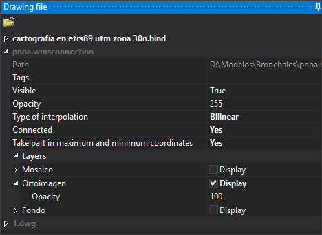
Initially no layers are active. Expand Layers and enable Display on desired layers.
| Property | Description |
|---|---|
| Path | .wmsconnection path. |
| Tags | Drawing file tags. |
| Visible | Shows or hides every connection layer. |
| Opacity | File opacity, 0 (transparent) to 255 (opaque). |
| Type of interpolation | Bilinear or Closest neighbor. Bilinear produces clearer zoomed images at greater computational cost. |
| Connected | Yes requests images on every zoom change. |
| Take part in maximum and minimum coordinates | Yes includes layer extents when calculating zoom extents. |
| Layers | One entry per layer, using its title. Display toggles it; Opacity sets 0–100 (default 100). Sublayers appear under their own Layers category. |
4. Result
With Display enabled, server imagery appears beneath cartography:
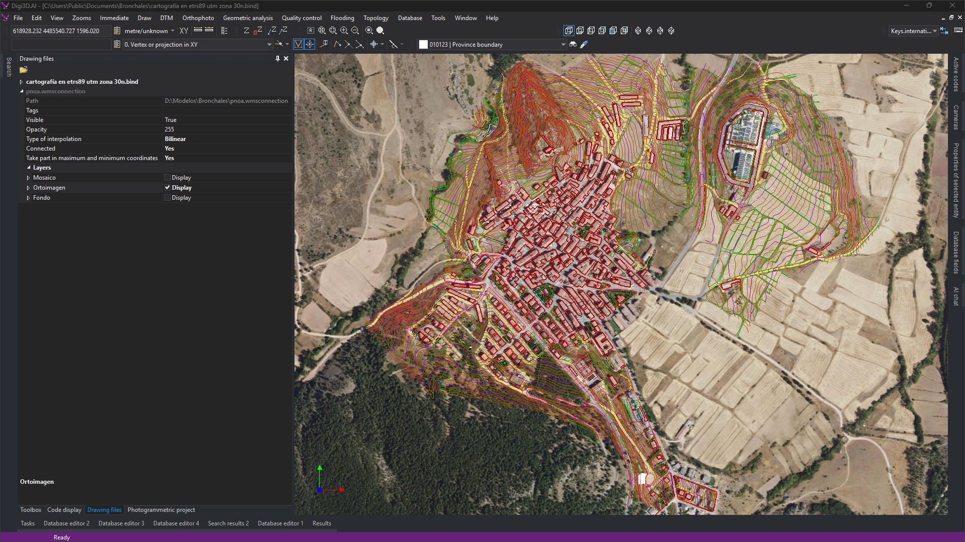
While Connected is Yes, each zoom change requests active layer images for the visible area.
See also
- WMS (Web Map Service):
.wmsconnectionformat. - LOAD_F: load a reference file.
- Importers and exporters: supported formats.