Calculate asphalt boundaries
After road line classification, points are classified as asphalt. This tool checks results and corrects errors, displaying asphalt boundaries.
The dialog can extract boundaries from asphalt and/or road marking points for subsequent editing. Boundaries remain in memory and can be edited by drawing a new boundary segment with the left mouse button, finishing with the right button.
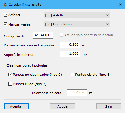
Parameters:
- Asphalt:
- Road markings
- Boundary code
- Work only on the current selection
- Maximum distance among points
- Minimum surface area
- Classify other types:
- Unclassified points
- Object points
- Noise points
- Height tolerance
See also: