Extract breaklines
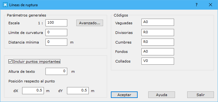
This tool automatically generates breaklines defining a point set. The digital model must be smoothed first. Terrain trends locate valleys, ridges and points of geomorphological interest. The tool displays a dialog with the following fields:
- General Parameters: defines initial parameters to establish the magnitude of calculated elements:
- Scale: also change linear and area generalization values with Advanced....
- Limit of curvature: curvature value below which an element is not considered a breakline.
- Minimum distance: minimum distance of calculated elements, in meters.
- Codes: codes used to record the different calculated entities.
- Include important points: includes point elements. Specify the text height for their elevations and the text's offset from the point, in meters.
The result is a drawing file containing calculated breaklines and points of interest. Save it in DIGI BIN, AutoCad DXF, MicroStation DGN or ESRI ArcGIS Shape format.