Average flight lines
This tool averages spatially coincident laser points recorded from different viewpoints.
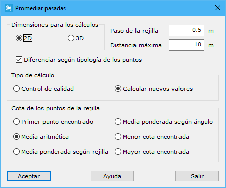
Required parameters:
- Calculation dimensions: 2D (LiDAR) or 3D (terrestrial laser).
- Grid step: averaged point spacing.
- Maximum distance: maximum distance for neighboring terrain points, based on point density. Defines the area covered by each measurement point.
- Distinguish by point type
- Calculation type:
- Quality control
- Calculate new values
- Grid point elevation: choose:
- First point found: elevation of the first point within the local area at the specified density.
- Arithmetic mean: mean elevation of all local points at that density.
- Grid-weighted mean: elevation weighted inversely by each point's distance to the area's center.
- Angle-weighted mean: elevation weighted inversely by recorded LiDAR angle.
- Lowest elevation found: lowest local point elevation.
- Highest elevation found: highest local point elevation.
Available only with more than one measurement source point or flight line.
See also: